En
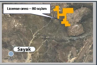
Balkhash Region, Central Kazakhstan. Licence area — 80 km². Closest city — Balkhash (270 km via paved road + field road). From Almaty — 430 km, from Astana — 500 km.
High voltage power available, paved road access, railroad nearby, regional airport. Multiple major operating mines in the region.
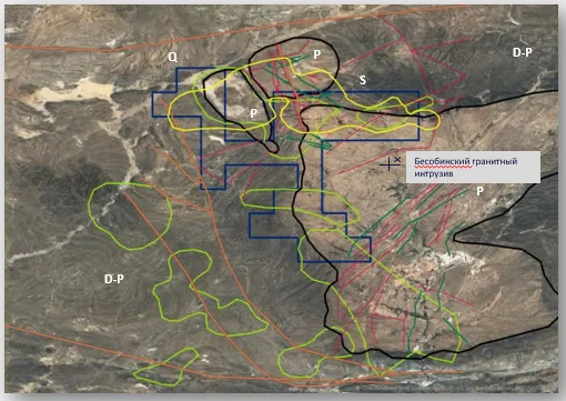
The licence sits along prominent geosyncline complexes to the north and northeast of Lake Balkhash (North Balkhash Megasynclinorium). The volcano-sedimentary sequence within the area is intruded by the Besoba granite massif and by dykes of granite porphyry and dioritic porphyrites. The region hosts 12 known Au/Cu deposits with a combined endowment of 3 Moz Au.