En
Teniz Basin, Central Kazakhstan. Land position — 2,077 km² across 9 approved licences, with 3 additional licences in progress.
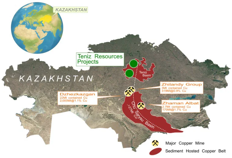
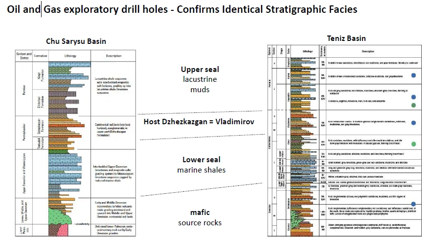
The Teniz project occupies the northern extension of the Chu-Sarysu Basin — the same basin that hosts the giant Dzhezkazgan deposit (2 Bt @ 1.1% Cu, 22 Mt of contained copper). Oil and gas exploration data confirm identical geological conditions: the same source rocks, the same structural setting, the same host rocks, and the same access to reductants (methane, oil). Surface copper occurrences demonstrate the same fluid transport mechanism and mineral precipitation style as Dzhezkazgan.
Soviet-era resources: 2.36 Mt @ 1.42% Cu — with no modern exploration carried out to date.
According to the USGS (2010), the area carries exceptionally high prospectivity for the discovery of large sediment-hosted copper deposits. The current licence position encompasses the highest prospectivity zones as defined by that assessment.
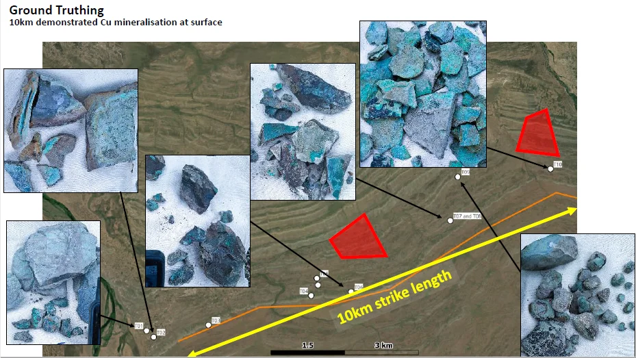
A minimum of 5 priority target zones have been defined based on the following criteria: