En

LAKESIDE PROJECT

More than 1,800 square kilometers have been acquired on a promising site with porphyry mineralization and developed infrastructure.
  • City of Balkhash (mining industry hub) — 25 km away.
  • Licences border two active mines.
  • Located along a major north-western porphyry corridor.
  • Seven individual porphyry targets identified.
  • Alteration zones indicate that the entire porphyry system is uneroded (intact).
  • Main railway line and power transmission line.
  • Paved access roads, copper smelter, and airport.

Favourable location within Kazakhstan’s copper- and gold-bearing volcanic belts.

According to palaeoreconstructions and regional settings, Central Kazakhstan represents an assemblage of Devonian–Carboniferous continental volcanic belts, two of which hold significant potential for epithermal gold and copper-porphyry deposits. Among numerous deposits and occurrences, large copper-porphyry objects stand out — Kounrad, Aktogay, and Aidarly — with copper reserves of approximately 5 million tonnes.

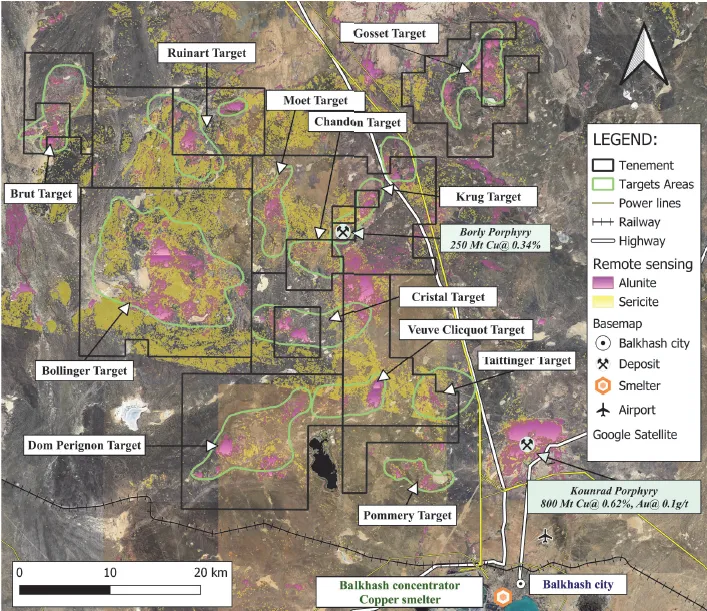
The most prospective licences are situated along the margins of these volcanic belts. These zones are characterised by extensive granodiorite and granite intrusions, highly complex tectonic structure, and are considered promising for gold and porphyry copper exploration.

KEY EVIDENCE

  • Remote sensing data (alunite, sericite, silica).
  • Alteration zonation: high-temperature argillic, phyllic, and propylitic zones.
  • Geochemical anomalies ($Cu, Au, Mo, As, Se, Pb, Zn$).
  • Historical mineral occurrences ($Cu, Au$).
  • Proximity to known copper-porphyry deposits (Kounrad, Pribrezhnoye, Borly).

SCOPE OF WORK COMPLETED IN THE 2024 SEASON

  • Desktop studies (analysis of existing data).
  • Processing of historical data.
  • Geological mapping (lithology, metasomatic alteration, mineralisation).
  • Soil geochemical sampling (on 400×400 m and 200×200 m grids).
  • Pan concentrate and channel sampling (rock chip collection).
  • Interpretation of acquired data.

RESULTS OF THE 2024 FIELD SEASON

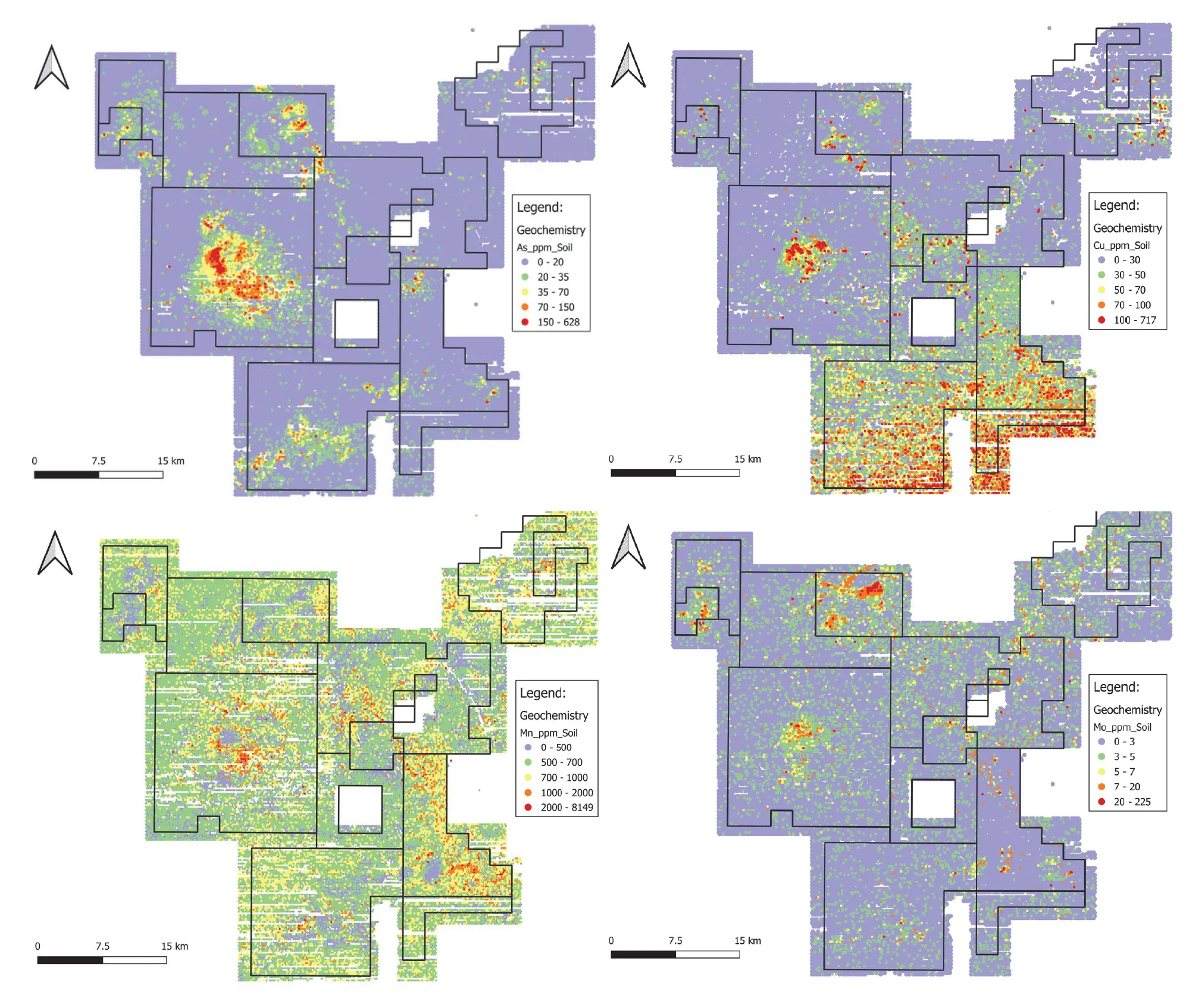
Detailed desktop and field work identified the main prospective targets. The mapping programme covered the licence areas and included study of lithology, alteration features, and mineral occurrences. Rock chip sampling was carried out at the most prospective locations and yielded positive results, while soil geochemical sampling covered the entire licence area. Analysis of soil samples revealed correlation with alteration zones and mineral occurrences. Elevated concentrations of $Cu, Mo$, and $As$, as well as pronounced manganese ($Mn$) depletion, were recorded at the main target areas.

SOIL GEOCHEMICAL SAMPLING RESULTS

Contact us

Information
Working days
Monday – Friday
Working hours
09:00 – 18:00 (GMT+5)
Create the future with us